Stroll Reports 2021
Stroll Reports April to December (no strolls before April due to Covid restrictions)
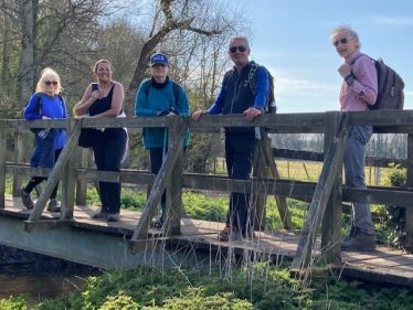
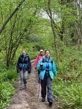
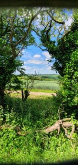
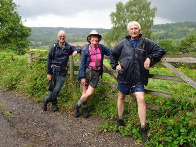
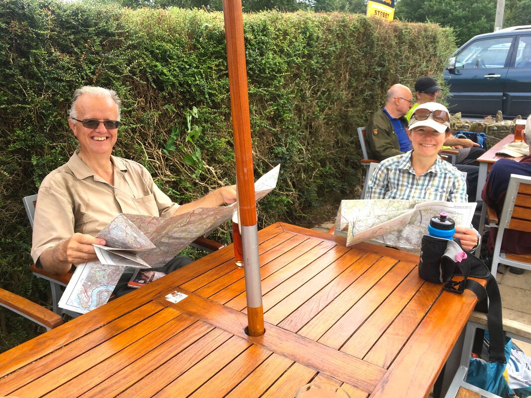
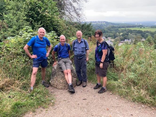
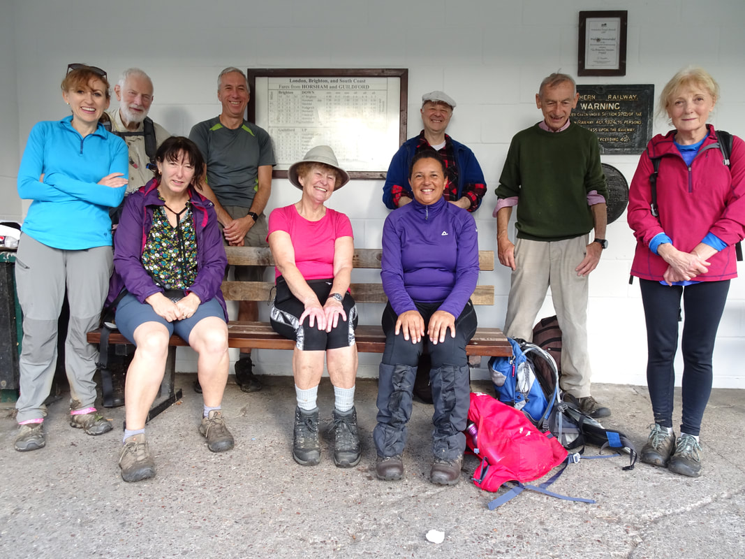
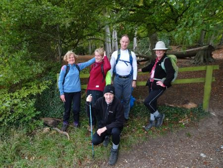
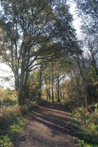
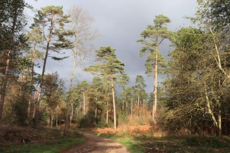
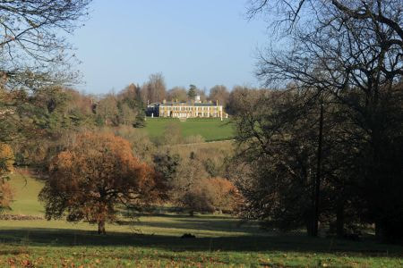
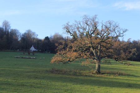
Farnham Circular -17 April
Conductor: Jill Goddard
Participants: Jill (conductor), Chris K, Rachel, Ian, Nigel, Lilian.
Stroll Report by Jill:
Six SWC members enjoyed a 19-mile spring walk from Farnham on 17 April. Chris, Jill, Ian, Lilian, Nigel and Rachel headed south from Farnham through Lower Bourne and out onto Alice Holt Forest and then the more open Farnham Heath and Tankersford Common. We stopped briefly at Pierrepont Farm to take advantage of a local cheese shop (mine had ripened a lot by the end of the day!!), and then had a coffee stop overlooking the lovely Frensham Little Pond. We continued on sandy heathland over the King's Ridge and round the Great Pond before crossing the Flashes and up the Devil's Jumps, where we enjoyed great views in all directions over lunch.
The afternoon route took us across Hankley Common, where staff were very coy about what filming was going on up there. We used good tracks to take a path alongside the River Wey into Tilford and a quick tea stop before returning to Farnham through Moor Park.
Distance 17/18 miles. Photographs Jill and Rachel.
**************************************************************************************************
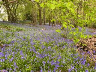
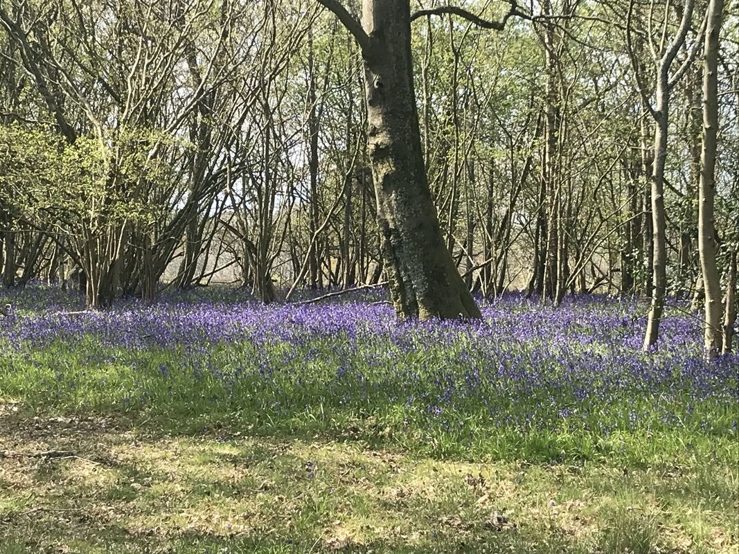 The Bluebells
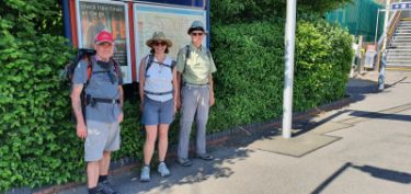
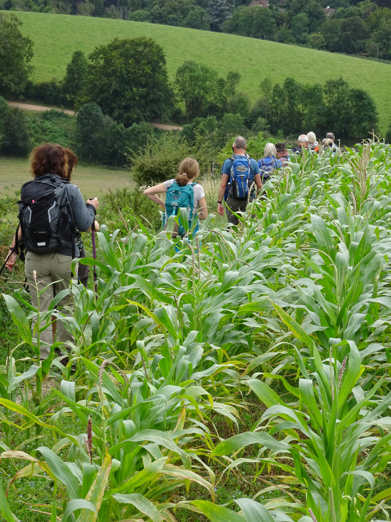
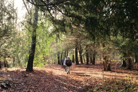
Horsley Circular (via Albury) - 1 May
Conductor: Andy Shoesmith
Participants: Andy (conductor), Deborah, Samantha, Stephen and Rachel.
Stroll Report by Andy:
Starting from Horsley station we went through Effingham Forest over the Downs and down to Gomshall, then on to Shere and Albury, for lunch round the war memorial!
Then back up to the North Downs Way and a tea stop at the excellent refreshment van in the West Hanger car park. Finally back through Sheapleas to Horsley.
We were lucky with the weather. Just a few spots of rain. Amazing amount of bluebells throughout the walk.
Distance 17.5 miles. Photograph Andy.
**************************************************************************************************************
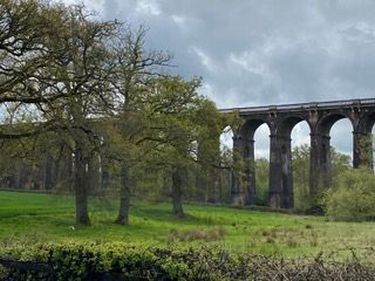
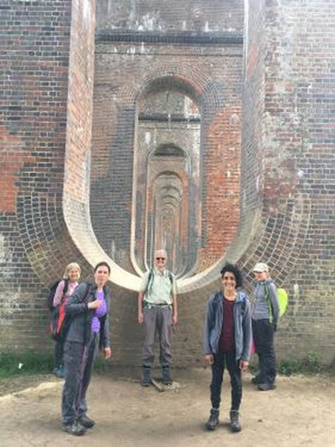 Group at Ouse Valley Viaduct
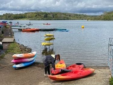
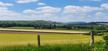
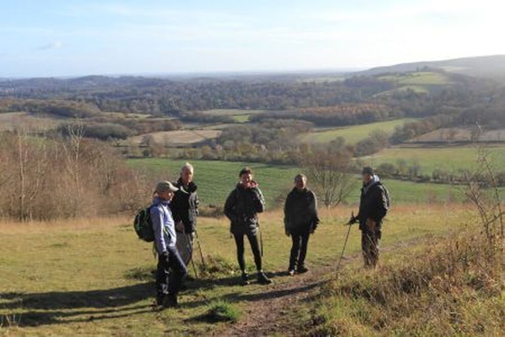
Balcombe Circular - 15th May
Conductor: Nick White
Participants: Nick (conductor), Kate, Manjinder, Samantha, Carol, Charlotte.
Stroll Report from Nick: We arrived on time at Balcombe station in the Mid Sussex District of West Sussex for a walk in this attractive part of the countryside. The weather forecast was variable to say the least, but we only had a few showers and managed to keep reasonably dry. We set off westwards towards the impressive gardens and park of Nymans (National Trust) with its small delightful lake and Japanese pavilion. On the way through Nymans we passed many huge redwood trees, one of which is said to be the largest in Sussex.
We passed through Handcross and crossed the busy A23 by bridge before taking the long peaceful track to Slaugham (pronounced 'Slaffam'). St Mary's Parish Church, Slaugham, has a Norman font made of Sussex marble with a fish symbol on it. There is a brass in the church to a John Covert. Ironic that his name sounds like “Covid” because, of course, we couldn’t actually go in to see any of this. In the churchyard there is a 600-year-old yew tree some 10 metres in circumference. Slaugham Place, now in ruins, was once a great Elizabethan manor house. It was the residence of the Covert family, who in the sixteenth and seventeenth centuries held land extending from the English Channel to the banks of the Thames. It is now a popular venue for wedding receptions, complete with helicopter landing space!
We stopped for our lunch break at the village green of Staplefield. There are two pubs on the green but, as the weather was unpredictable, we quickly ate our packed lunches and moved on. There followed a pleasant walk down to the River Ouse where we were lucky enough to spot a small herd of deer.
We continued down into the valley and under the Ouse Valley Viaduct - a surprisingly impressive structure, built in 1842 for the London to Brighton Line. Then on through fields, sometimes a bit muddy, and up slopes until emerging to the slightly surprising sight of a huge reservoir. This is Ardingly Reservoir, a particularly beautiful location, popular for boating and paddle boarding. The weather held off here and we had a lovely long walk around it. There is always something relaxing about walking alongside water. We were now heading back to Balcombe.
We encountered yet another shower but fortunately it didn’t last long. On arriving in the village of Balcombe a few of us said our farewells to those who had driven and nipped back to the station just in time for the train.
Distance 16 miles. Photographs Charlotte and Kate.
**************************************************************************************************************
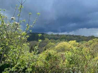
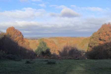
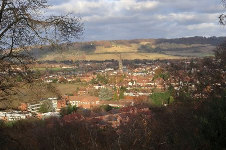
 A Beautiful View
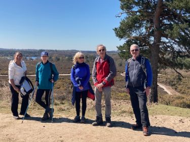
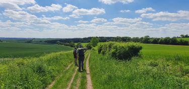
Overton Circular - 12th June
Conductor: Lynne McKenzie
Participants: Lynne (conductor), Nick, Barry and Isobel
Stroll Report from Lynne: Four intrepid walkers were not put off by the rising temperatures and set off from Overton at 9.50 a.m. We headed away from Overton towards Watership Down. There were beautiful views with big open skies. There was some shade which was much needed. We parked ourselves on a steeple chase fence after 5 miles for a well-deserved break.
Onwards to lunch at Kingsclere which involved a steep downhill at Freemantle Down. As we descended to the gallops we saw a large group of riders. As advertised Kingsclere has all a walker could ask for in terms of shops, cafe and pubs. We had all brought packed lunches which were enjoyed in the shade of the churchyard.
Off then for the 8.3 miles back to Overton. A slight deviation in the route (chatting can cause these issues) and we made an unexpected detour through Hannington. This turned out to be fortuitous as it is a beautiful village. The conductor remarked that this was a good mistake to have made. Back following the pink line on the OS Maps app we strode through the paths in ever increasing temperature and afternoon sunshine. We were all happy to reach the station with 10 mins to spare for the once per hour train.
Stats: 18.4miles in 5 hours 42 mins of walking. A great effort by the quartet. Pictures by Lynne.

**************************************************************************************************************
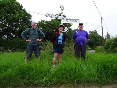
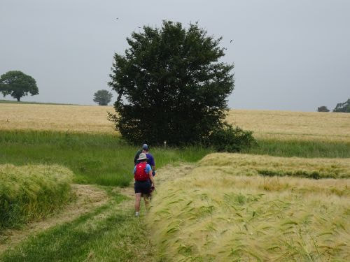
Sawbridgeworth Circular - 27 June
Conductor: Gregory Noble
Participants: Gregory (conductor), Gail, John and Neil.
Stroll Report from Gregory:
The group set off from the station under low clouds having rained earlier yet with plenty of warmth. We passed through the grounds of Great Hyde Hall. The conductor was very surprised to find that the vegetation had grown considerably since his recent recce but after a circuit of an adjoining field, watched by two languid horses, the exit from the grounds was found. Once back on the correct path, we passed through an undulating patchwork of fields with crops well on their way to ripening and enjoyed their scent. The noise from the M11 was soon left behind as we wended our way into the parish of Little Hallingbury. Noise from Stansted flight traffic was noticeably absent too, which added to the delight of the walk.
The group enjoyed the excellent westerly views of the surrounding countryside from the top of the slope leading to the village of Hatfield Broad Oak. The village had manicured lawns and would normally be deemed quiet on a Sunday, except we had the misfortune to witness an incredibly loud tune coming from a bright pink ice-cream van as it did several circuits of the village notifying the residents of its arrival.
By this point we had reached the furthest easterly point of the loop, so on passing out through the village, we proceeded in a south westerly direction initially, followed by westerly.
We had odd glimpses of the embattled sun as it tried to burn off the low clouds, but this was in vain. After passing along a short section of Sheering’s main road, the group turned off into more fields of crops only to hear and see the M11 again. Gail was able to assist the conductor, with the help of Gerry The Pacemaker (Garmin sat-nav), after he missed a track. On re-tracing our steps, the route was located and we passed straight through a field of swaying wheat to a footbridge that passed over a busy M11.
We arrived in Lower Sheering very much looking forward to our lunch time food stop since it was now gone 2pm. The conductor left Gail, John & Neil to enjoy their sandwiches in the shadow of Sawbridgeworth’s church of The Great St Mary, while he sped towards the White Lion for a Sunday roast. After a 45min delay in receiving the food, the conductor hastily consumed it, upon which the group reconvened and considered changes to the stroll since it was now 3:30.
A truncated version of the stroll that ended at Harlow Mill railway station was hastily agreed upon and the group set off, skirting Pishiobury Park, taking in part of their wetland nature reserve which borders the Stort Navigation canal. We eventually picked up a path along the side of the canal which brought us to the main road and eventually the station. The group commented that it had been a most enjoyable walk in unspoilt Essex, particularly as there were so few fellow walkers on the path.
As the conductor left the rail travellers, the sun appeared to have won its battle to burn through the clouds, but alas it was short lived.
Distance 16 miles. Photographs John.
**************************************************************************************************************
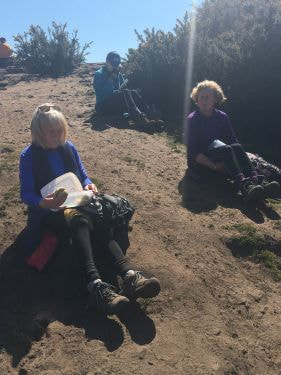
Cowden Circular - 10 July
Conductor: Kate Copeland
Participants: Kate (conductor). Paul T, Dave T, Andy S, Debs, Sally, Keith, Danusia, Samantha, Neil, Charlotte, Nick W, Carol.
Stroll Report from Kate:
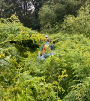
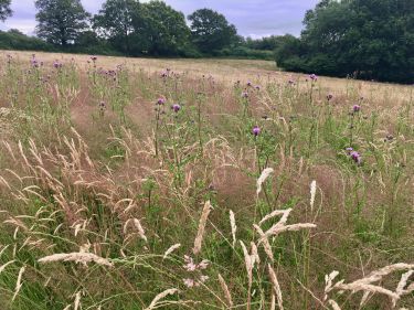
We set off from Cowden at 10am exactly, having all seen the weather forecast so were dressed appropriately for the next 3 hours of drizzle. Oddly everyone seemed in good spirits about the rain, even looking forward to it in some cases. It is a very unpopulated route which has many benefits and also means there was a lot of long grass and ‘thriving’ undergrowth at this time of year. In one place the bracken was five foot taller than on the original recce in April and, surely, one foot taller than the final recce the week before! Given how wet the ferns were, it was a bit like going through car wash rollers. See Keith’s photo of us forging our way through what we hoped was the path. Danusia remarked that it reminded her of trailing gorillas in Uganda. We saw a kestrel and a deer but that was as far as the exciting wildlife went. In fact, we only passed one horse and rider and three dog walkers the entire day. We also waved at a small group of Capital Walkers across a field. They were walking from Ashurst to Hever and told us that the Metropolitan Walkers were also in the area that day.
Due to the weather and nature of the walk we ended up with three twenty minute breaks rather than one long lunch break, which seemed to work well. So we stopped at the Perryhill Orchard café for fortifying cups of tea six miles into the walk and then moved on to a covered glade with just the right number of fallen trees to provide seats for all for a late picnic lunch. We also had time for a swift pint and some leader-baked banana bread at The Fountain Inn in the very pretty village of Cowden. The walk takes in farmland, meadows and woodland and there were some fabulous colours from the barley and long grasses along the way. There were plenty of pretty houses to drool over, both large and small, including Bolebrook Castle which was apparently the hunting lodge from which Henry VIII chased wild boar and deer on Ashdown Forest, before wooing the ill-fated Anne Boleyn at her family seat of Hever Castle about five miles away.
We arrived with twenty minutes to spare for the 6pm train. The group were extremely upbeat (at least within the leader’s earshot) about the unseasonal amount of mud we encountered on the way and the mood was good the whole day. It’s possible that Paul mentioned something about wishing there were a few more stiles but the remark was somewhat indistinguishable.
Distance 18 miles.Photographs Kate and Keith.
Conductor: Kate Copeland
Participants: Kate (conductor). Paul T, Dave T, Andy S, Debs, Sally, Keith, Danusia, Samantha, Neil, Charlotte, Nick W, Carol.
Stroll Report from Kate:
We set off from Cowden at 10am exactly, having all seen the weather forecast so were dressed appropriately for the next 3 hours of drizzle. Oddly everyone seemed in good spirits about the rain, even looking forward to it in some cases. It is a very unpopulated route which has many benefits and also means there was a lot of long grass and ‘thriving’ undergrowth at this time of year. In one place the bracken was five foot taller than on the original recce in April and, surely, one foot taller than the final recce the week before! Given how wet the ferns were, it was a bit like going through car wash rollers. See Keith’s photo of us forging our way through what we hoped was the path. Danusia remarked that it reminded her of trailing gorillas in Uganda. We saw a kestrel and a deer but that was as far as the exciting wildlife went. In fact, we only passed one horse and rider and three dog walkers the entire day. We also waved at a small group of Capital Walkers across a field. They were walking from Ashurst to Hever and told us that the Metropolitan Walkers were also in the area that day.
Due to the weather and nature of the walk we ended up with three twenty minute breaks rather than one long lunch break, which seemed to work well. So we stopped at the Perryhill Orchard café for fortifying cups of tea six miles into the walk and then moved on to a covered glade with just the right number of fallen trees to provide seats for all for a late picnic lunch. We also had time for a swift pint and some leader-baked banana bread at The Fountain Inn in the very pretty village of Cowden. The walk takes in farmland, meadows and woodland and there were some fabulous colours from the barley and long grasses along the way. There were plenty of pretty houses to drool over, both large and small, including Bolebrook Castle which was apparently the hunting lodge from which Henry VIII chased wild boar and deer on Ashdown Forest, before wooing the ill-fated Anne Boleyn at her family seat of Hever Castle about five miles away.
We arrived with twenty minutes to spare for the 6pm train. The group were extremely upbeat (at least within the leader’s earshot) about the unseasonal amount of mud we encountered on the way and the mood was good the whole day. It’s possible that Paul mentioned something about wishing there were a few more stiles but the remark was somewhat indistinguishable.
Distance 18 miles.Photographs Kate and Keith.

**************************************************************************************************************
 A Lovelace Bridge
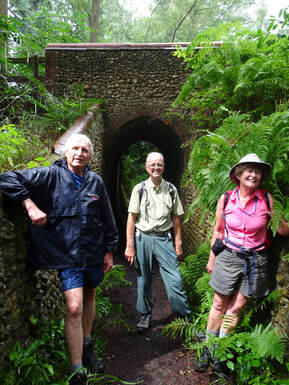
Clandon Circular– 25 July
Conductors: Gail and John Elrick
Participants: Nick and Stephen plus Gail and John (conductors).
Stroll Report from Gail and John:
The conductors have led several strolls over the years using Clandon as a hub. They thought it might be a good idea to use one of these routes as a Summer stroll in the latest Strolls Programme, the first to be produced since the onset of COVID. When we set the date of the stroll a few months before we had no idea of how free from COVID restrictions we would be. In the event, the weather was the major factor with a week of high temperatures up to 30 degrees Centigrade being replaced rather suddenly by forecasts of torrential rain and thunder. Two brave souls joined us on the day and our thanks to them for stoically putting up with the very wet conditions after lunch.
The first part of the route passed through Clandon Regis Golf Club and East Clandon village to cross the A246 and head upwards into the Sheepleas. Avoiding the myriad of paths going off in all directions, the conductors headed through the woods to join the lane at Honeysuckle Bottom and from here we joined the Lovelace Bridges Trail through the woods. This trail takes in the bridges built by Earl Lovelace, the owner of the East Horsley Estate in the mid-19th century, to facilitate the transport of timber by horse cart from his woods to the depot. Our route took us under some of the restored bridges which are notable for their use of local brick and flint and their rounded tiled tops.
We turned southwards and crossed over the North Downs Way (NDW) to head downwards for lunch at Westcott. So far there had been no heavy rain and the conductors did not need to implement Plan B which was to shorten the afternoon stretch by following the North Downs Way back towards Clandon. On entering the village we paused to look at a plaque on the wall of a house where the actor Leslie Howard, best known for playing Ashley Wilkes in the Hollywood film ‘Gone with the Wind’ (1939), lived until his untimely death in 1943, aged 50.
We took possession of the tree on the village green with its tree seat but the arrival of the rain caused a rapid departure by all for the nearby thatched bus shelter. From now until the end of the walk the rain was virtually continuous, although the wooded route gave us some shelter. We dried out at the Abinger Hammer village shop/tea rooms opposite the empty cricket field and then made good progress back up to and along the North Downs Way as far as the top of Clandon Downs. On a long Summer evening this would offer a splendid view across the cultivated fields, but this time there was only rain and mist to see. Descending along the edge of the field required avoiding the quite large animal holes (bunnies or badgers?), but we couldn’t avoid getting very wet as we brushed through the long grass. We reached the railway station via the empty golf course and Nick was able to catch the 6.00 p.m. train back to London.
Distance 20 miles. Photographs John.

**************************************************************************************************************
 Dave Williams Sees Us Off
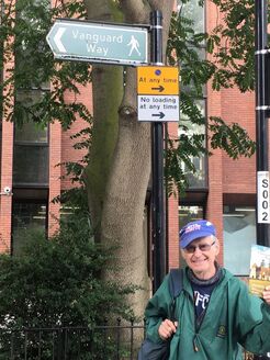
The Vanguard Way - East Croydon to Newhaven 28, 29 and 30 August
A Note from Kate. The aim was to walk the whole of the Vanguard Way over the August Bank Holiday weekend. This had been postponed for over a year due to Covid, meaning that we fortuitously coincided with the VGW’s 40th anniversary. The route itself is 66 miles but with the necessary diversions to and from train stations, it ended up at about 70 miles. People came and went over the three days, generating energy for the group, and everyone who joined us added something unique to a memorable event.
We began with 18 walkers and ended with 8. The mileage increased each day, as did the average walking speed (and the trouble caused by Southern Rail!), whilst the time taken for breaks reduced. It would be nice to think we could have been mistaken for a team of crack Navy SEALs by the time we approached Newhaven but it’s possible we all felt more like the lumbering aquatic mammals of the same name. We were honoured to have Colin Saunders, route creator and Vanguard Rambler Extraordinaire, to greet us at the end. Another highlight was to have Dave Williams as our bookends. He waved us off under the very first signpost for the route in East Croydon, and emerged from the pub at the end to congratulate us on finishing.
Thank you to EVERYONE who joined us or contributed to an excellent outing.
Vanguard Way Day 1 - Croydon to Edenbridge - Saturday 28 August
Conductor: Keith Lane
Participants: Keith (Conductor) Gail, John, Jessica, Gavin, Laurence, Andy, Deborah, Nick, Samantha, Joelle, David H, Kate, Gillian, Ron, Cathy, Danusia and Richard
Stroll Report from Keith: Dave Williams attended the start at East Croydon Station with a copy of the 1973 guide to see us off.
The Vanguard Way utilises Croydon streets and alleyways heading for Lloyds Park, after which it follows bridle ways and footpaths and undulates notably through woods until it reaches open countryside at Chelsham.
The normal one hour lunch stop was split into half hours and the first was The Bull Inn at Chelsham. Despite the Conductor warning the Strollers of a particularly grumpy landlord the female staff could not have been more welcoming, opening the pub 15 minutes early to accommodate us.
Shortly after the pub stop we reached Nole Hill (856 ft) the highest point of the day and had a steep descent after a particularly difficult stile. Following Nole Hill there was a notable ascent to the top of the North Downs before another steep descent through Beech Plantation.
After crossing the M25 the route crossed farmlands before ascending over Watts Hill to Limpsfield Chart and the second refreshment stop at The Carpenters Arms which was reached at 15:30. This enabled all to avail themselves of liquid refreshments before the Conductor’s allotted time of 16:00 to start the final 5 miles to ensure we would be on the 18:09 train from Edenbridge without a panic surge.
Another notable descent on a tarmac road took us into the Eden Valley and passing through the Guildables we reached the Edenbridge Golf Course. Colin Saunders has recently provided waymark posts and managed the installation of them across the golf course which resolved the problem of the previously difficult and confusing crossing.
After leaving the Vanguard Way at the allotted place for Kate Copeland to continue the next day, the Strollers reached Edenbridge Station in good time for the 18:09 train.
Distance 20 miles. Photographs Gavin, Kate and John.

Vanguard Way Day 2 – Edenbridge to Buxted - Sunday 29 August
Conductor: Kate Copeland
Participants: Kate (Conductor) Mary-Anne Pilkington, Jill Goddard, Gail, John, Gillian, Nick, David, Jessica, Cathy, Danusia, Gavin, Richard
Stroll Report from Kate:There were 13 of us on Day 2. We had said goodbye to many the afternoon before and gained Jill and Mary-Anne that morning.
Whilst sunshine and heat are nice, they’re not what you need on a 22.5 mile walk, especially over the exposed, muggy area of Ashdown Forest. We had T-shirt weather, a fair bit of cloud and no rain, which is the best we could have asked for. The start of the walk is through pretty fields and meadows, crossing the Eden River and Kent Brook. There were several sunflowers lining the runway and taxiway of the local airfield. We passed Starborough Castle, which is more of a manor house now, and stopped for a mid-morning break on top of Dry Hill. There are Iron Age fort remains up here but we seemed more intent on eating our snacks than working out the lie of the land. We were intrigued to pass a house named Vanguards and can only assume it’s been built in the last 40 years and named after the route.
We headed into Forest Row (locally known as ‘Fro’) for a 30 minute lunch stop. After lunch, we headed up onto Royal Ashdown Forest Golf Course where the leader set up a very short quiz – an observation round to discern ‘what is unusual about this golf course?’ Some very wild guesses ensued until Danusia hit on the correct answer: it has no bunkers. It was felt that an old course has enough natural hazards without having any artificial ones added.
We had lovely views in all directions from Ashdown Forest. Most stopped at the posher of the ice cream vans but one, who shall remain nameless, eschewed this in favour of a double chocolate 99 Mr Whippy from the further van. We reached The Crow & Gate pub at Poundgate just before 4pm where we celebrated one esteemed walker’s significant birthday with chocolate brownies (and candles it was hard to keep alight in the breeze). It was still two hours or so back to Buxted. The final 5 miles are also very attractive, returning to meadows and then woodland. The vanguard saw about 20 deer just before High Hurstwood. This was the second sighting of the day.
Alas, an excellent day screeched to a halt at the end of the VGW itself when we discovered that all trains from Buxted were cancelled. We doggedly worked our way through 20 taxi phone numbers to no avail. So the commuters waited bravely for a very slow rail replacement bus. They got home 2-3 hours after they had planned and, of course, had early starts the next morning. Those staying at The Buxted Inn and dining at The White Hart did look rather brighter-eyed than the rest the following morning.
Distance: 22.5 miles. Photographs Gavin, Kate and John.
Vanguard Way Day 3 - Buxted to Newhaven - Monday 30 August
Conductor: Gavin Fuller.
Participants: Gavin (Conductor) Richard, Kate, Gillian, Jessica, David, Cathy, Mary-Anne, Nick.
Stroll Report by Gavin: After the fun and games the evening before, any hopes that getting back to Buxted for the septet commuting from London were dashed when the train was cancelled, necessitating a diversion to Haywards Heath and a somewhat expensive taxi ride to get to the revised starting point where the Vanguard Way transects the A272. Fortunately the nine still standing for the final push to the end were only half an hour later than planned on departing this point. Also of assistance was the fact that the route was considerably less muddy than when the conductor had recce’d it a month previously, although there were some interesting fields of crops to get through, and that this was the least hilly of the three days, with only 1,011ft of ascent between the starting and end points, both of which helped the group maintain a good pace throughout the day.
The session to lunch at Chiddingly 8.5 miles in was done without a break, enabling some time to be regained, even though some of the stiles en route kept up the theme of being in less than perfect working order. On we carried through a Mohair centre and past a fine Georgian building at Mays Farm to Berwick, where we were forced to wait when one member had the level crossing barriers descend before they could cross; we spent the time looking in vain for a sight of Dave Williams. The tea break came after 18 miles in Alfriston, where the majority retired for a well-earned drink in Ye Olde Smugglers Inne, before the final push began.
This contained the stiffest climbs of the day where the route intersected with the South Downs Way, a trio of ascents which provided a shock to the system after the relative flatness of the day prior to then. Successfully negotiating these, there was one final haul over Seaford Head, from the summit of which the end was in sight. Seaford saw one of the group depart for their B&B before completing the route the following morning, but the remaining eight struggled along the tarmac of the sea front and an overgrown path (although considerably less so than when first recce’d by Gavin in June) through the ruined tidal mills to reach journey’s end at Newhaven after 27.2 miles, completed in under 10 hours since departure. A reception committee of Dave W and Colin Saunders was waiting at the Engineer along the road to greet the party, who could for the most part celebrate having walked the LDP in three days, save Mary-Anne who completed it the following day by doing the first stage, and receive a certificate to commemorate their achievement. A happy end to an enjoyable bank holiday weekend walk; now what shall we do next?
Distance 27.2 miles. Photographs Kate, Gavin and Dave Williams.
**************************************************************************************************************
Redhill to Edenbridge - 11th September
Conductor: Keith Lane
Participants: Keith (Conductor), Gail and John
Stroll Report from Keith:
Flummoxed does not come close to the emotion felt by Keith Lane, the Conductor of this Stroll when, at his local station he realised that the planned trains to Redhill were seriously delayed. He had put this Stroll in the programme twice before. The first time was in 2019 when the weather forecast was calamitous and as only two Strollers turned up a decision was made to shorten the route to finish at Oxted. The second time was in 2020 when it was cancelled falling foul of lockdown. So following the end of lockdown this year he decided to add it to the programme on the mistaken belief that nothing further would go wrong.
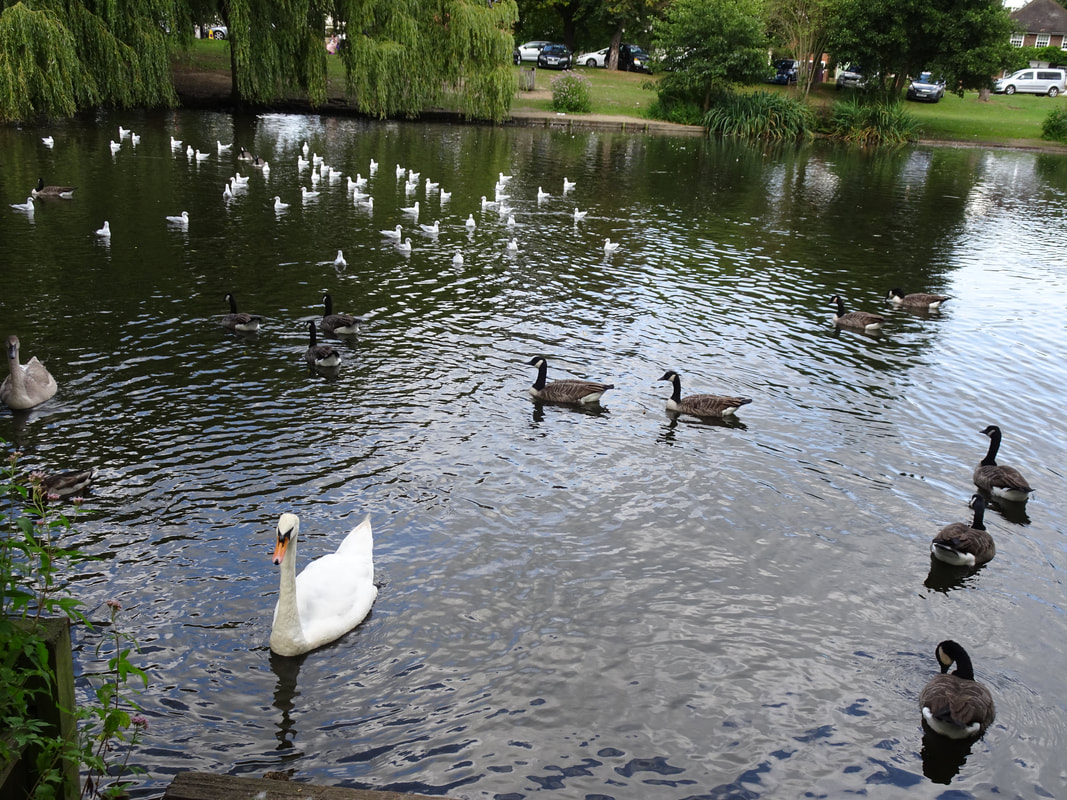
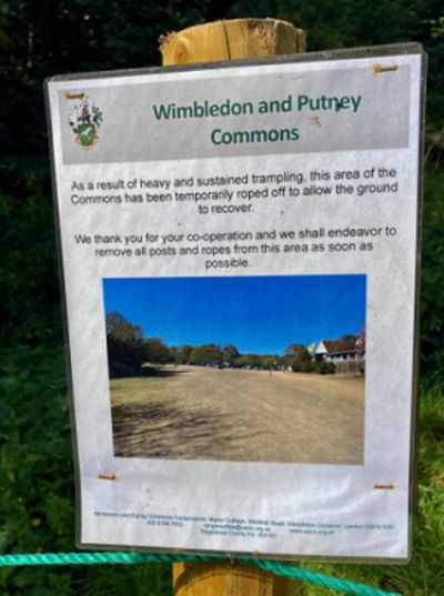
Some trains were running to East Croydon station, however, and the Conductor met up with Gail & John Elrick. Noting that the indicator board was showing the first train to Redhill would not be until 11:16 a decision was made to re-route to somewhere they could get to; namely Wimbledon, and the Strollers Three had a pleasant day finishing at Richmond and refraining from sustained trampling on Wimbledon Common (see photo).
Keith will not be inserting this jinxed route into future programmes which is a great pity as it is a varied and at times challenging Stroll of two halves finishing at Edenbridge from a different direction to the Vanguard Way. However not all is lost, Keith is claiming the record for the most unsuccessful attempt to lead a Stroll in the history of the Surrey Walking Club!
Distance: Perhaps 12 miles not including the Tram ride. Photos: John and Keith.
Conductor: Keith Lane
Participants: Keith (Conductor), Gail and John
Stroll Report from Keith:
Flummoxed does not come close to the emotion felt by Keith Lane, the Conductor of this Stroll when, at his local station he realised that the planned trains to Redhill were seriously delayed. He had put this Stroll in the programme twice before. The first time was in 2019 when the weather forecast was calamitous and as only two Strollers turned up a decision was made to shorten the route to finish at Oxted. The second time was in 2020 when it was cancelled falling foul of lockdown. So following the end of lockdown this year he decided to add it to the programme on the mistaken belief that nothing further would go wrong.
Some trains were running to East Croydon station, however, and the Conductor met up with Gail & John Elrick. Noting that the indicator board was showing the first train to Redhill would not be until 11:16 a decision was made to re-route to somewhere they could get to; namely Wimbledon, and the Strollers Three had a pleasant day finishing at Richmond and refraining from sustained trampling on Wimbledon Common (see photo).
Keith will not be inserting this jinxed route into future programmes which is a great pity as it is a varied and at times challenging Stroll of two halves finishing at Edenbridge from a different direction to the Vanguard Way. However not all is lost, Keith is claiming the record for the most unsuccessful attempt to lead a Stroll in the history of the Surrey Walking Club!
Distance: Perhaps 12 miles not including the Tram ride. Photos: John and Keith.
**************************************************************************************************************
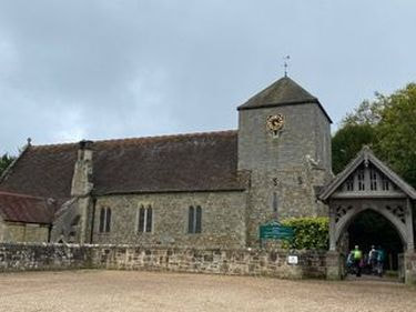
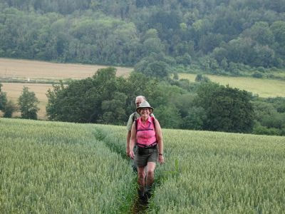
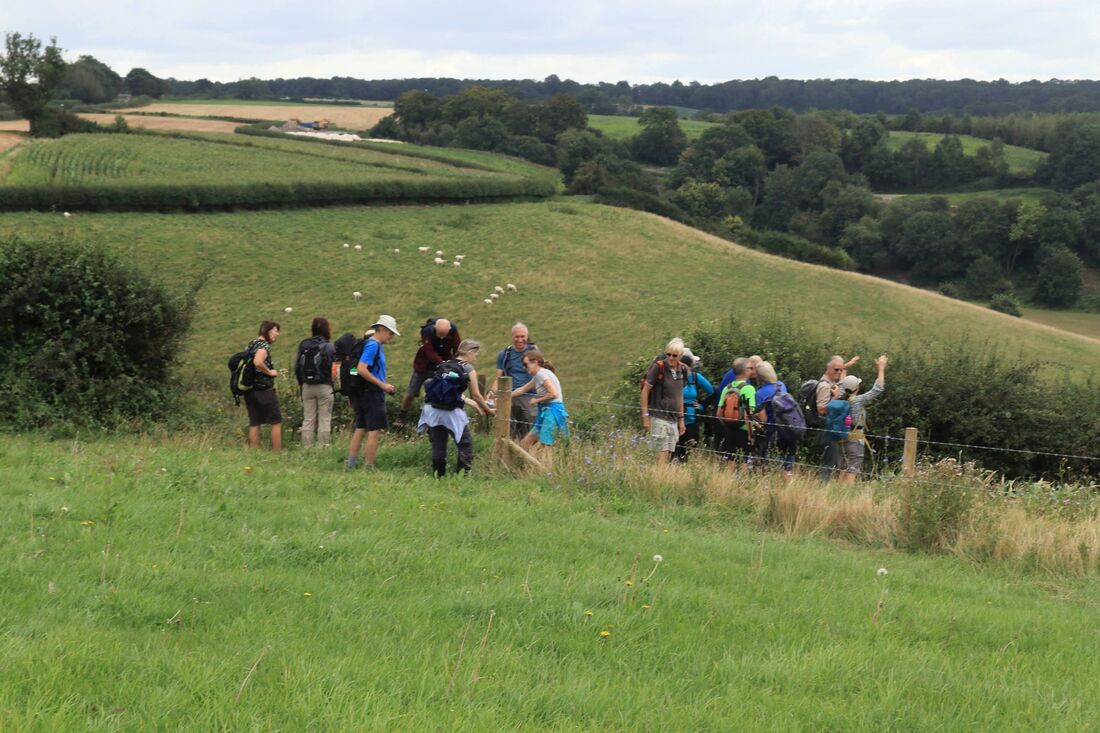
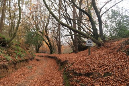
Alton Circular - 25 September
Conductor: Jill Goddard
Participants: Jill (Conductor), Laurence, Andy, Debs and Stephen.
Stroll Report from Jill:
A group of five strollers (Laurence, Andy, Debs, Stephen and Jill) enjoyed a 19-mile circular walk from Alton back in September. The route started out on the Hanger's Way, leaving Alton via East Worldham and then following took less walked paths through orchards, meadows and woods up to Noar Hill where we had a short detour to see the medieval chalk workings and junipers of the nature reserve. We continued to Selborne for lunch and then went up the famous zig zag path to enjoy the great views of the hangers of north Hampshire. We crossed the attractive common area to reach Newton Valence and on to Farringdon and then the literary village of Chawton where we stopped for tea, returning to Alton on field paths. With summer bowing out, we were fortunate to have fine weather and dry paths.
P.S. The large golf balls in the distance in the photograph are RAF listening devices in giant radome globes and dishes.
Distance 19 Miles. Photograph Jill.
The Team
**************************************************************************************************************
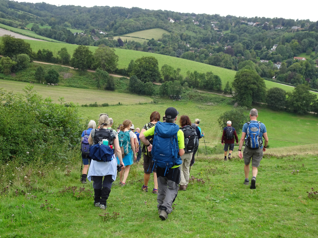
Godalming Circular - 10 October
Conductor: Andy Shoesmith
Participants: Andy (Conductor), Debs, Chris K, Jenny, Kate, Tony (new joiner), Laurence, Carol, Rachel, Nigel, Gail and John.
Stroll report from Andy:
12 of us started out at Godalming station on a cool but dry Sunday morning (the walk had been put back a day to allow people to attend the LDWA London group ceremonial walk on Saturday). After heading up out of the valley and through the woods, we climbed up to Hydon's Ball, the highest point of the day and thought to be named after signalling equipment that was once sited here. It also contains an extra large stone seat as a memorial for Octavia Hill, who was one of the originators of the National Trust and a campaigner for social housing.
After Hydon's Ball we went through farmland to pick up the Greensand Way and eventually connecting with the Downs Link path, which we followed into Cranleigh for lunch. Cranleigh has supermarkets, cafes, M&S food and pubs, so all were well catered for. 2 of the starters left at Cranleigh, so 10 of us continued.
After lunch, we walked through Cranleigh School and on to the Wey South path, then back onto the Downs Link to Bramley, where we had a short stop at the abandoned Bramley and Wonersh station. From Bramley it was up and over the hill to the Wey valley and back along the river to Godalming.
All in all a good day, with a very slight sprinkling of rain late morning, but unfortunately no tea stop as they all closed early on Sunday.
Distance 18.5 miles. Photographs John.
The Seat on Hydon's Ball
**************************************************************************************************************
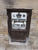 Letter box outside the Old Post Office, Penshurst
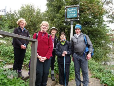
Sevenoaks to Hever - 23 October
Conductor: Lynne McKenzie
Participants: Lynne (Conductor) Kate, Gail, Keith, Richard, Nick
Route Description (from Strollers Newsletter no 75): In the morning we walk from Sevenoaks via Knole Park and the Greensand Way on to the High Weald through the rolling tidal landscape of Kent to lunch in Leigh. Lunch is either on the village green or Fleur de Lis pub. In the afternoon we pass two castles, a stately home and the two lovely villages of Chiddingstone and Penhurst. The hope is to find a tea stop in Chiddingstone.
Distance: 17 miles. Photos Nick.
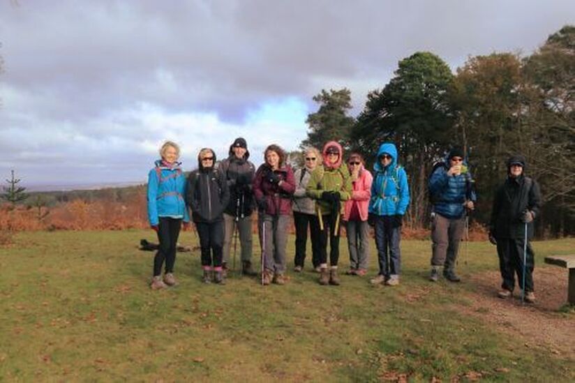
The Group all 'Tired' out
*************************************************************************************************
Reading Circular - 6 November
Conductor: Janette Platt
Participants: Janette (Conductor) Lilian, Jill, Gail, Simon and John
Route Description (from Strollers Newsletter no. 75): From Reading Station we head straight for the south bank of the Thames to pick up the Thames Path heading west. Shortly after passing Tilehurst Station we turn inland to pass through Purley on Thames before joining the Berkshire Circular Routes to Tidmarsh (passing some WW2 pillboxes on the way). We head back to the Thames along the banks of the River Pang, crossing the Thames at Pangbourne and stopping for lunch at The Greyhound in Whitchurch-on-Thames (named after the original Saxon ‘white church’). After lunch we pick up the Thames Path again (north bank this time) heading west. As we emerge from Lower Hartslock Wood we head up a short sharp hill and make a brief stop at the top to take in the lovely view towards Goring Gap. We then start on the return journey to Reading via Whitchurch Hill and Mapledurham (where there is a grand Elizabethan house and church which was the setting for The Eagle Has Landed), eventually crossing back over the Thames at Caversham Bridge to return to Reading Station.
Distance: 20 miles. Photographs John.

**************************************************************************************************
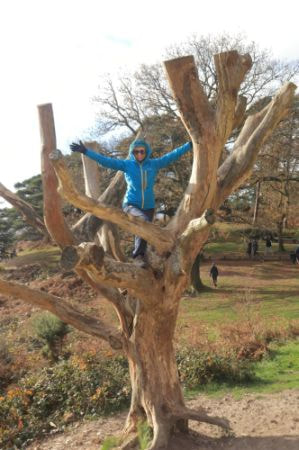 Kate in Tree, Leith Hill
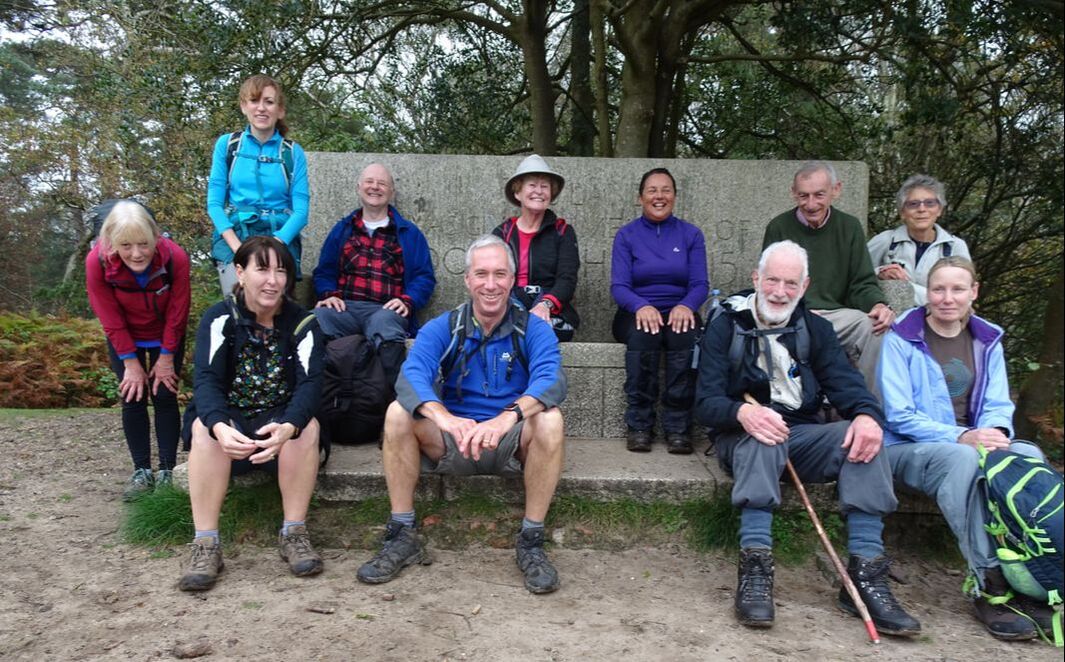
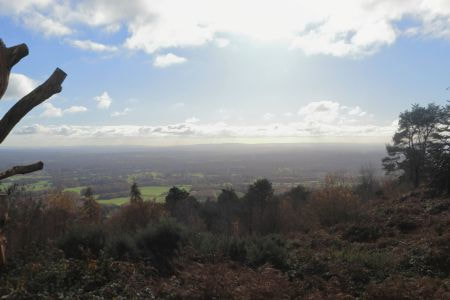
Dorking Circular - 21 November
Conductor: Gavin Fuller
Participants: Gavin (Conductor), Gillian, Samantha, Paul, Adam, Kate, Gill, Mary-Anne, Lilian, Jayne and Dorte
Stroll Report from Gavin
Once getting the car park ticketing system to work online was sorted a group of 11 set off from a sunny Dorking station on a crisp November morning. Passing over the former sporting venue of the Cotmandene the route exited through the quiet Glory Wood en route to Holmwood Common, both looking lovely in their autumnal hues in the sunshine. After a stop at the viewpoint on the common the walk passed into Abinger Forest, with a few spots of rain as it continued on its undulating course up across Coldharbour Common to the lunch spot atop a somewhat brisk Leith Hill.
Slow service at the café meant that only those who went straight into the queue were able to be served by the time people were ready to go, whilst the sight of young lads tree climbing proved too much of a lure for Kate, who simply had to copy their exploits! The considerably flatter afternoon took the group across Wotton Common to Friday Steet, then across the Wotton Estate to the Rookery with its attractive cottages before a final climb to the top of the Nower.
After a short break on the top it was back down through Dorking, where conductor Gavin revealed that the butcher after whom The Old Butcher’s House in West Street is named was his great-grandfather before a final green space in Meadowbank took the group back to the station.
Distance 15.8 miles and 1,701ft of ascent. Photographs Gavin
Surrey Strollers on Leith Hill
**************************************************************************************************
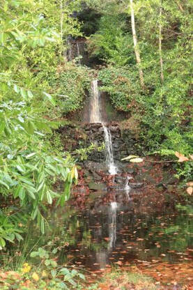 Waterfall in Wooton Estate
Box Hill Circular - 4 December 2021
Conductor Lilian Chelli
Participants: Lilian (Conductor), Sally, Paul, Rachel,Carol, Gavin and John R for part.
Stroll Report from Lilian:
Five strollers joined Lilian at Box Hill Station on a lovely December day: Sally Adams, Paul Tilley, Rachel Birchall, Carol Buss, and Gavin Fuller. It was muddy underfoot, but we made our way through the Polesden Lacey Estate with only the occasional slip, and enjoyed extensive views from the top of the North Downs. We were joined by John Royds at the railway bridge at the foot of the Downs. We’d found out earlier in the week that The Wotton Hatch, our original lunch stop, was fully booked. So we followed a revised route to The Prince of Wales in Westcott where Lilian, Rachel, and John enjoyed an excellent lunch.
We then followed a section of the Greensand Way to The Wotton Hatch where John left the party. Gavin experienced problems with his boots, but apart from this the rest of the afternoon was uneventful, as we passed Friday Street Mill Pond, and descended steeply through the woods to Logmore Green. Rachel and Lilian enjoyed a lovely tea in Esquires Cafe in Dorking, and completed the rest of the stroll through Denbies Vineyard in the dark.
Distance 16 miles approx. Photos Gavin.

Surrey Strollers at Pickett's Hole
**************************************************************************************************
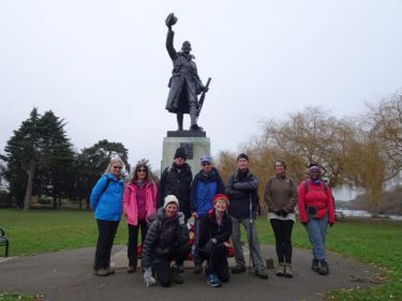
Group at War Memorial in Radnor Gardens, Twickenham
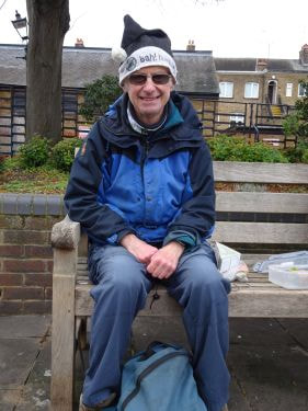 Dave wearing his Bah! Humbug! Mr Scrooge Hat
Hampton Court to Richmond – Sunday, 19 December 2021
(a linear walk via two palaces and five historic houses and a crossing of Pope's Grotto)
Conductors: John and Gail Elrick
Participants: Gail and John (conductors), Bola, Dave W, Keith, Lynne, Paul, Sally and visitors Jayne and Dorte.
Stroll report from John:
The conductors devised this stroll to connect a series of palaces and historic buildings in the local area, whilst offering a chance to walk along the River Thames and through local parks. As well as all these offerings, a high point of the day was the tea stop at the recently opened Eileen’s Café on Richmond riverside.
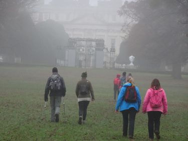
Eight strollers met us at Hampton Court station. The stroll began in thick mist and it was difficult to see each other let alone any historic buildings as we left Hampton Court station. We had Home Park virtually to ourselves as we walked around the park’s edge to reach the rear of Hampton Court Palace, looming eerily out of the mist. Entering Bushy Park, we stopped to view a team of shire horses and carriage circling round the Diana Fountain, and then headed directly through the park to Teddington Gate, by which time the mist had more or less cleared.
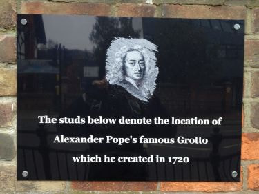
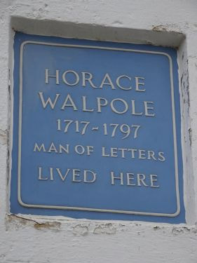
Dave and Keith met us at Teddington station. Heading down Waldegrave Road we passed two blue English Heritage plaques to Edward Whymper (who climbed the Matterhorn in 1865), and Noel Coward (marking the house in which Coward was born) and crossed over Alexander Pope's (underground) Grotto; (there are marks on the pavement to denote its presence, see photo below). We soon reached the restored Strawberry Hill House where we paused to view the gardens of Horace Walpole’s 18th century “little Gothic castle”. Continuing to Twickenham centre the group ate sandwiches on the embankment and sampled the very good coffee made at Esquires Coffee Shop. Full of caffeine we bounced along to Twickenham’s Naked Ladies statue at the historic York House where we took an obligatory group photo in front of the ladies. From there it was quickly on to Orleans House, named after Louis-Philippe, Duc d’Orleans, who subsequently became King of France in 1830, and then past Marble Hill House, a Palladian villa sloping down to the Thames created and lived in by Henrietta Howard, Countess of Suffolk, in the 18th century.
After crossing Richmond Bridge we stopped briefly to view the tallest Plane Tree in London beside Gaucho’s restaurant and continued on the towpath to Ham House, our fifth and final historic house. Looping round across Ham Common we crossed Richmond Park and Petersham Meadows to reach Eileen’s Café. This small building at Buccleuch Gardens, once a toilet block and now redeveloped, serves excellent tea, coffee and cakes. The conductors indulged in some excellent Victoria sponge cake before leading the group towards Richmond. We passed through what little remains of Richmond Palace and crossed Richmond Green to finish at the station.
Distance: 16 miles, photographs John.
(a linear walk via two palaces and five historic houses and a crossing of Pope's Grotto)
Conductors: John and Gail Elrick
Participants: Gail and John (conductors), Bola, Dave W, Keith, Lynne, Paul, Sally and visitors Jayne and Dorte.
Stroll report from John:
The conductors devised this stroll to connect a series of palaces and historic buildings in the local area, whilst offering a chance to walk along the River Thames and through local parks. As well as all these offerings, a high point of the day was the tea stop at the recently opened Eileen’s Café on Richmond riverside.
Eight strollers met us at Hampton Court station. The stroll began in thick mist and it was difficult to see each other let alone any historic buildings as we left Hampton Court station. We had Home Park virtually to ourselves as we walked around the park’s edge to reach the rear of Hampton Court Palace, looming eerily out of the mist. Entering Bushy Park, we stopped to view a team of shire horses and carriage circling round the Diana Fountain, and then headed directly through the park to Teddington Gate, by which time the mist had more or less cleared.
Dave and Keith met us at Teddington station. Heading down Waldegrave Road we passed two blue English Heritage plaques to Edward Whymper (who climbed the Matterhorn in 1865), and Noel Coward (marking the house in which Coward was born) and crossed over Alexander Pope's (underground) Grotto; (there are marks on the pavement to denote its presence, see photo below). We soon reached the restored Strawberry Hill House where we paused to view the gardens of Horace Walpole’s 18th century “little Gothic castle”. Continuing to Twickenham centre the group ate sandwiches on the embankment and sampled the very good coffee made at Esquires Coffee Shop. Full of caffeine we bounced along to Twickenham’s Naked Ladies statue at the historic York House where we took an obligatory group photo in front of the ladies. From there it was quickly on to Orleans House, named after Louis-Philippe, Duc d’Orleans, who subsequently became King of France in 1830, and then past Marble Hill House, a Palladian villa sloping down to the Thames created and lived in by Henrietta Howard, Countess of Suffolk, in the 18th century.
After crossing Richmond Bridge we stopped briefly to view the tallest Plane Tree in London beside Gaucho’s restaurant and continued on the towpath to Ham House, our fifth and final historic house. Looping round across Ham Common we crossed Richmond Park and Petersham Meadows to reach Eileen’s Café. This small building at Buccleuch Gardens, once a toilet block and now redeveloped, serves excellent tea, coffee and cakes. The conductors indulged in some excellent Victoria sponge cake before leading the group towards Richmond. We passed through what little remains of Richmond Palace and crossed Richmond Green to finish at the station.
Distance: 16 miles, photographs John.

*************************************************************************************************